We’ve all been there. You're driving along, enjoying your coffee, listening to a podcast, and then—BAM!—you hit a pothole that feels like it could swallow your entire tire. You mutter a few choice words, check your rearview mirror for your hubcap, and carry on, maybe making a mental note to complain to the city later (which you probably won't).
Behind that single, infuriating pothole is a massive, often thankless, operational challenge for public works departments everywhere. Keeping our roads safe and our infrastructure in check is a relentless task of patrolling, inspecting, and prioritizing repairs. It’s traditionally involved teams in trucks, with clipboards and cameras, spending countless hours just trying to keep up. It's a tough gig.
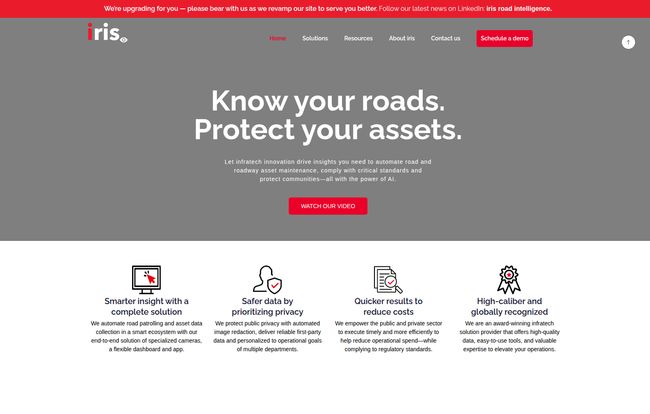
But what if you could give your city’s vehicles a pair of superhuman eyes? Eyes that never blink, never get tired, and can spot a problem from a mile away? That's the world we're stepping into. And that’s where I stumbled upon a company called iris roads. Their whole pitch is about using AI to automate this grind, and I’ve got to say, I was intrigued.
So, What Exactly is Iris Roads?
In a nutshell, iris roads provides a complete system—specialized cameras and smart software—that basically turns any vehicle in a municipal fleet into an automated road patrol unit. Think of it as a dashcam on steroids, with a PhD in civil engineering.
The system is built around two core components: the IrisGO camera, which is the hardware that does the seeing, and the IrisIQ software, which is the brain that analyzes all the visual data. The idea is simple: as city vehicles go about their normal routes (think garbage trucks, by-law vehicles, supervisor pickups), the camera automatically scans the road and surrounding environment, collecting a treasure trove of data. This isn't just a video feed; it's actionable intelligence.
Sidenote: I noticed their main website is getting a facelift right now, which to me is usually a sign of a company that's growing and reinvesting. Good on them.
Visit iris roads
How It's Changing the Road Patrol Game
The old way of doing things was reactive. A citizen complains, a crew is dispatched to verify, a work order is created, and eventually, the pothole gets fixed. It's a slow, manual, and expensive dance. Iris wants to flip the script to a proactive model, and here's how they're doing it.
Automated Deficiency Spotting
This is the bread and butter of the system. The AI is trained to identify and categorize all sorts of road deficiencies without a human having to manually tag anything. We're talking about:
- Potholes and cracks in the pavement
- Faded or damaged traffic signs
- Blocked catch basins
- Broken guardrails
And the best part? Every single issue it logs is automatically geotagged with precise coordinates. No more vague reports like “there’s a big pothole somewhere on Elm Street.” Now, it’s “a category 3 pothole is located at 43.6532° N, 79.3832° W.” That’s a game-changer for repair crews.
Mastering Your Pavement Condition Index (PCI)
If you're not in public works, the term 'PCI' might sound like corporate jargon. It's basically a standardized grade, from 0 to 100, that rates the health of a stretch of pavement. Calculating this traditionally is… an ordeal. It involves painstaking visual surveys and a lot of number crunching. Iris automates this survey, providing a continuous, objective PCI rating for the entire road network. For a city planner, this is gold. It helps them decide which roads need a complete overhaul versus which ones just need a little TLC, optimizing massive budgets in the process.
A Living Inventory of Your Roadside Assets
Beyond just finding what's broken, the system also builds a comprehensive inventory of everything on the roadside. It catalogues every traffic sign, fire hydrant, guardrail, and manhole cover. Why does this matter? It's crucial for compliance with safety regulations, maintenance planning (knowing how many signs of a certain type you have and when they'll need replacing), and budget forecasting. It turns the city’s infrastructure from a static, outdated spreadsheet into a dynamic, living map.
The Big Wins: Efficiency, Safety, and... Privacy?
Okay, the tech is cool. But what about the results? One case study I saw on their site claimed a partner city saw a drop in service calls by over 80%. Let that sink in. That isn't just a number; thats a massive reduction in angry phone calls and a huge boost in public satisfaction. It means problems are being found and fixed before residents even have a chance to complain.
The safety implications are pretty clear. Proactively fixing a faded stop sign or a dangerous pothole can literally prevent accidents and save lives. But here's the bit that really caught my eye: their approach to privacy. The idea of city-affiliated cameras constantly recording our streets can feel a bit... Big Brother. Iris seems to have anticipated this. Their software includes automated image redaction, which blurs out faces and license plates. It’s a small feature with huge implications, showing a level of foresight and public respect that you dont always see in the tech world.
Let's Talk Brass Tacks: The Potential Hurdles
Now, I’m an optimist, but I’m also a realist. No solution is perfect for everyone. Some might argue against a system like this, and in my experience, they usually have a point worth considering.
First, there's the initial investment. This isn't a free app you download from the App Store. It requires specialized cameras, software licensing, and setup. For a small town with a tight budget, this could be a significant hurdle. The argument, of course, is that the long-term savings in operational costs and accident prevention outweigh the upfront expense—a classic investment-vs-expense debate.
Second, there’s the tech integration. Most municipalities run on a patchwork of existing systems, some of which might be... let's say, vintage. Integrating a modern AI platform with a 20-year-old work order system isn't always a simple plug-and-play operation. It requires some technical expertise.
Finally, the system is only as good as the data it gets. The old saying “garbage in, garbage out” is brutally true here. A camera with a muddy lens or poor placement isn’t going to provide the high-quality data needed for the AI to work its magic.
The Million-Dollar Question: What Does Iris Roads Cost?
This is the part where I'd love to show you a neat little pricing table. But I can't. Like most enterprise and B2G (Business-to-Government) platforms, iris roads doesn’t list public pricing on their website. And honestly, it makes sense.
The cost for the City of Toronto would be vastly different from a small town in rural Kansas. Pricing is almost certainly customized based on factors like:
- The size of your vehicle fleet.
- The total mileage of your road network.
- The specific features and modules you need.
- The level of integration and support required.
Their model is to get you to schedule a demo, walk you through the platform, and then build a quote tailored to your specific needs. It's the standard industry playbook for a reason.
My Final Take
As someone who spends a lot of time looking at tech trends, I believe tools like iris roads are the future of public works. It's a practical application of AI that solves a real, tangible problem. It’s not a flashy, abstract concept; it’s about filling potholes faster and keeping signs from falling over.
It’s part of a larger, more grounded “smart city” movement that focuses on improving the nuts and bolts of civic operations. For any public works director or city manager feeling like they’re drowning in a sea of reactive maintenance, this kind of technology could be a lifeline. The proactive approach to safety and the thoughtful inclusion of privacy features make it a pretty compelling package.
Frequently Asked Questions about Iris Roads
What is the main problem Iris Roads solves?
It solves the inefficiency and high cost of manual road and asset inspection. It automates the process of finding deficiencies like potholes and damaged signs, allowing public works teams to be proactive rather than reactive.
Is this system just for finding potholes?
No, not at all. While pothole detection is a key feature, it also conducts full Pavement Condition Index (PCI) surveys and creates a detailed inventory of all roadside assets, including traffic signs, guardrails, fire hydrants, and more.
How does it protect citizen privacy?
The system uses AI to automatically redact, or blur, personal information from the images it captures. This includes people's faces and vehicle license plates, ensuring privacy is maintained while still collecting valuable infrastructure data.
Can it integrate with our city's current software?
Yes, the platform is designed to integrate with existing municipal systems, such as GIS (Geographic Information System) and asset management or work order software. This helps create a smooth workflow from detection to repair.
Who is the ideal customer for Iris Roads?
The ideal customers are municipalities, cities, counties, public works departments, and the engineering firms that consult for them. Any organization responsible for maintaining a large network of public roads and infrastructure can benefit.
Do you need a special vehicle to use the IrisGO camera?
No, and that's one of its strengths. The IrisGO camera is designed to be easily mounted on almost any vehicle in an existing fleet, such as garbage trucks, supervisor vehicles, or street sweepers, turning them into mobile data collection platforms.
The Road Ahead
Technology like this isn't about replacing the skilled people who maintain our cities. It's about equipping them with better tools so they can work smarter, safer, and more efficiently. It’s about turning a mountain of work into a manageable molehill. And if it means I hit fewer car-swallowing potholes on my morning commute, then I’m all for it. The road ahead looks a lot smoother.