I’ve been in the SEO and traffic game for a long time. You see a lot of trends come and go. One minute it’s all about one shiny object, the next, it’s something else entirely. But one thing that never changes is the power of good data. Not just big data—that’s just a firehose—but actionable, intelligent data. The kind that turns a guess into a strategy.
For years, this has been the holy grail for industries that operate on the ground. Think farming, forestry, resource management. How do you get a true, real-time picture of thousands of acres without an army of surveyors and a mountain of guesswork? It's a massive challenge. So when I stumbled upon EOS Data Analytics (EOSDA), I was intrigued. Not just as a tech guy, but as someone who’s seen firsthand how the right information can completely change a business's trajectory.
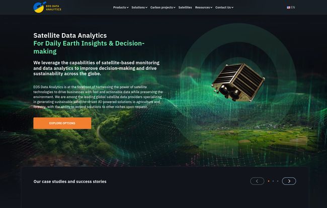
This isn't just another SaaS platform with a slick landing page. Founded by Dr. Max Polyakov, a name with some real weight in the tech and space industries, EOSDA feels different. They're promising to give businesses a literal eye in the sky. So, is it all marketing fluff, or is there something genuinely powerful here? Let's take a look.
What Exactly is EOS Data Analytics?
Let's break it down without the corporate jargon. EOSDA uses AI to analyze images and data from satellites. Simple, right? But the implications are huge. They’re basically building a living, breathing digital map of our planet and then teaching computers to understand what they’re seeing. This isn't just about taking pretty pictures of Earth from space; it's about interpreting crop health, tracking deforestation, monitoring water levels, and a whole lot more. Their main game is in agriculture and forestry, but the tech is flexible enough to be pointed at all sorts of problems.
They’re on a mission to use this incredible perspective to support sustainable decision-making. That's a goal I can get behind. It's one thing to build cool tech; it's another to aim it at solving some of our biggest environmental and agricultural challenges.
More Than Just Pretty Pictures from Space
A platform is only as good as its tools. EOSDA isn't a single product but a suite of solutions designed to turn raw satellite data into something you can actually use. It’s the difference between being handed a 1,000-page book in a foreign language and being given the translated summary.
EOSDA Crop Monitoring: The Farmer's High-Tech Assistant
This is their flagship product, and it's easy to see why. For a farmer, information is everything. Is that section of the field getting enough water? Is there a pest outbreak starting in the north corner? Historically, finding this out meant walking or driving the fields, which is slow and often imprecise. EOSDA Crop Monitoring offers a dashboard that gives you a health report for your entire farm. It uses various vegetation indices (fancy terms for plant health metrics) to flag problem areas before they become disasters. It’s like having a farmhand who can see everything, all at once, from 500 miles up.
LandViewer and High-Resolution Imagery
If Crop Monitoring is the specialized tool, LandViewer is the powerful, all-purpose workbench. It provides access to a massive archive of satellite imagery from different sources. You can find, compare, and analyze images from today, last year, or even a decade ago. This is incredibly powerful for tracking long-term changes – urban sprawl, coastal erosion, the impact of a new irrigation system, you name it. Paired with high-resolution imagery, you're not just seeing colored blobs; you're seeing detail. You can zoom in and get a much clearer picture of what’s happening on the ground.
The Power of Custom Solutions and APIs
This is what separates the serious players from the pack. EOSDA knows that one-size-fits-all doesn’t work for complex industries. Through their API and custom solution development, they can integrate their data streams into a company's existing software or build a whole new analytical tool from scratch. Maybe an insurance company needs to assess hail damage across an entire state, or a government agency wants to monitor illegal mining operations. This is where their in-house team of experts really shines, building something specifically for the job at hand.
Visit EOS Data Analytics (EOSDA)
So, What’s the Big Deal? The EOSDA Advantage
Okay, the tech is cool. But lots of companies have cool tech. What makes EOSDA stand out in a crowded market? In my opinion, it comes down to a few core things.
First, their sustainable vision. It's woven into their entire brand identity. They aren’t just selling data; they're selling a better way to manage our planet's resources. In a world where ESG (Environmental, Social, and Governance) is becoming more than just a buzzword for investors, this is a massive plus. It gives their work a sense of purpose that you don’t always see.
Second, and this is a big one for me, is the human element. They repeatedly mention their in-house experts. These aren't just coders; they are scientists, agronomists, and data analysts with deep domain knowledge. This means when you have a problem, you’re not just submitting a ticket to a faceless system. There's a brain on the other end that actually understands the context of your problem. That is invaluable.
Finally, there's the sheer efficiency. I’ve worked with clients on data projects that took months of manual work. The idea of performing those same tasks in minutes is, frankly, mind-boggling. It’s a classic case of technology giving us a superpower we never had before.
Okay, Let's Be Real: The Potential Hurdles
No tool is perfect, and it's my job to be a little cynical. Blindly adopting any platform is a recipe for trouble. There are a few things that give me pause, or at least, things any potential user should be aware of.
The Elusive Pricing Question
If you head to their website looking for a pricing page, you'll come up empty-handed. This is pretty common for enterprise-level, custom solutions. You can't put a simple monthly price on a bespoke analytics project for a multinational corporation. However, it does create a barrier for smaller to medium-sized businesses who just want to know teh ballpark cost. You have to be willing to engage with their sales team to even get an idea of the investment required.
At the Mercy of the Satellites
The entire system relies on a steady stream of high-quality satellite data. What happens when there’s persistent cloud cover over your area of interest for a week? What if a specific satellite goes offline? While they pull from multiple sources to mitigate this, you are still fundamentally dependent on the hardware orbiting our planet. It’s a factor that's largely out of both your and EOSDA's control.
Is There a Learning Curve?
I'd bet on it. A platform this powerful isn't going to be as simple as your favorite social media app. To get the most out of tools like LandViewer or a custom API, your team will need to invest time in learning the system. It’s not a plug-and-play solution for every user, and expecting instant results without some training would be a mistake.
My Two Cents on the Whole Thing
After digging into EOS Data Analytics, I'm genuinely impressed. It’s a serious platform for serious users. It’s not for the hobbyist farmer or the small-town blogger. This is for large-scale agribusiness, forestry managers, governments and environmental agencies that need reliable, scaled data to make critical decisions.
It feels like a glimpse into the future of resource management. For decades, we've made decisions based on what we can see from the road or a small airplane. EOSDA offers a perspective that is both macro and micro at the same time—the ability to see the entire forest and the individual trees. It's a powerful proposition, and for the right organization, I believe it could be an absolute game-changer.
Frequently Asked Questions about EOSDA
- What industries does EOSDA serve besides agriculture and forestry?
- While Ag and Forestry are their specialties, their custom solutions can be applied to many sectors. Think insurance (damage assessment), energy (pipeline monitoring), mineral extraction, and government (environmental compliance and land use planning).
- How does EOSDA get its satellite data?
- They aggregate data from a wide range of public and commercial satellite constellations. This includes well-known programs like Landsat and Sentinel, as well as high-resolution commercial providers, giving them a broad and robust dataset to work with.
- Is EOSDA suitable for small farms?
- While their custom solutions are geared towards larger enterprises, the EOSDA Crop Monitoring platform could potentially be useful for smaller, tech-savvy farms. However, given the lack of public pricing, the cost-benefit would need to be carefully evaluated by contacting them directly.
- What is EOSDA Carbon?
- Based on their site, EOSDA Carbon is a new solution focused on monitoring and verifying carbon sequestration in soil. This is a hot topic, as it relates directly to carbon credit markets and sustainable farming practices. It's a smart move into a rapidly growing field.
- Do I need to be a data scientist to use their tools?
- Not necessarily. For a platform like EOSDA Crop Monitoring, the interface is designed to be a user-friendly dashboard. For more advanced features like LandViewer or API integration, some technical expertise or a willingness to learn is definitely beneficial.
The Final Takeaway
EOS Data Analytics is an ambitious and impressive company. They are tackling massive, real-world problems with cutting-edge technology and a clear, sustainable purpose. While it may not be the right fit for everyone due to the likely enterprise-level cost and potential complexity, for the right organization it represents a leap forward. It's the ability to make smarter, faster, and more environmentally-conscious decisions, all powered by a clear view from above the clouds. And in today's world, that's a perspective worth investing in.